
The Heritage-listed Emerald Fringe
A source of identity and point of difference for Coochiemudlo Island
Coochiemudlo’s heritage listed Emerald Fringe is a source of identity and a point of difference for the island’s residents, who value its natural, indigenous and aesthetic qualities, in addition to the sense of privacy and tranquillity that it offers.
The landscape of the Emerald Fringe demonstrates a unique and endangered coastal environment that encompasses diverse ecosystems, including littoral forest, tidal mangroves, foreshores with low-key recreational facilities, meeting areas, modest community monuments and no private residences.
The Emerald Fringe of Coochiemudlo Island is the area of land around the entire shoreline, encircling the Island. This area was part of the Island’s historical survey from 1885-1962 as an esplanade around the island.
The Emerald Fringe has remained unchanged in its extent and dimensions since its gazetting in 1885: It is 5395 metres in length, with a 41 hectare zone between the island’s private residential areas and the water’s edge of Moreton Bay. It comprises approximately one third of the island’s land mass.
Heritage listing
In 2018, the Coochiemudlo Island Heritage Society applied to list the Emerald Fringe on Queensland’s Heritage Register of places that have cultural heritage of significance. The application CIHS submitted is rich with historical documentation, images and newspaper clippings.
See our application to register our Emerald Fringe on the Queensland Heritage Register.
In 2019 the Queensland Department of Environment and Heritage recommended that the Emerald Fringe be added to the Redland City Council Heritage Schedule because of its cultural significance for the area.
See the letter from the Queensland Department of Environment and Science to Redland City Council.
Aspects of the Emerald Fringe
CIHS acknowledges and thanks the photographers who have contributed to the imagery on this website.
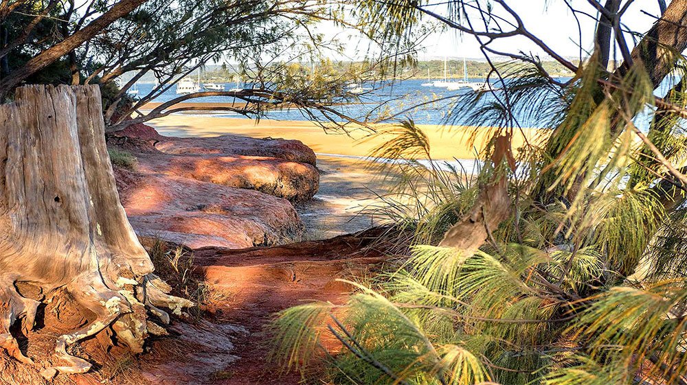
The red rocks that give Coochiemudlo its name, on the south west of the Island.

Approaching the island by water, just off Main Beach.

Large eucalyptus trees on the golf course, on the western side of the island.
South-east corner of the Emerald Fringe.
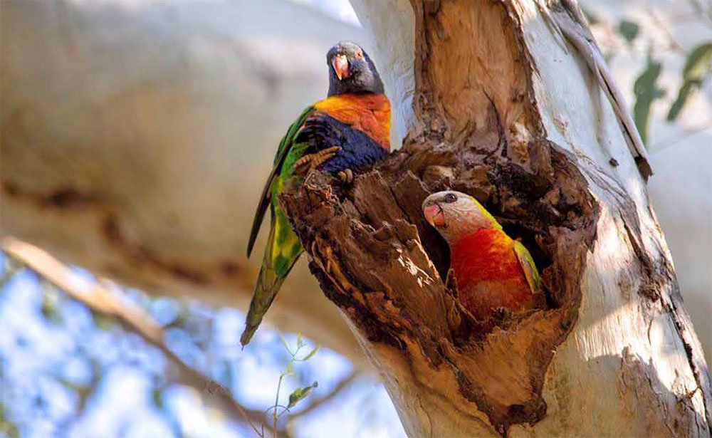
Lorikeets nesting in the Emerald Fringe, at Main Beach.

Cotton wood and mangroves on Morwong Beach.

Morwong Beach, northern shoreline
Main Beach, and jetty, on Coochie's southern shoreline (note the recreational fisher in the front).
A brief history of the Emerald Fringe
Coochiemudlo Island was known as Innis Island until the end of the nineteenth century. In 1885, Innis Island was surveyed by George MacDonald in accordance with the following directive:
You are requested to submit a design for the subdivision of the Western half of Innis Island off PointHalloran, Moreton Bay in acre allotments for auction sale. The whole of the frontage with a depth of not less than 150 links should be reserved.
Later, when the north-east and south-east of the island were surveyed into saleable lots, a similar reserve of sea coast was left. This meant that the island was completely encircled by a publicly-owned esplanade reserve.
Settler history
The first land sales on the island occurred in 1888. However, by 1895 the only permanent residents on Coochiemudlo were Henry Wright and his teenage son Norman, who learnt about bush tucker from local Indigenous people on the mainland whose ancestors had visited the island for 10,000 years or more. He later established Norman Wright and Sons, a nationally regarded boat building company that constructed was the MV Miramar, which made regular tourist cruises past Coochiemudlo until its conversion to a survey vessel in World War II.
In the early 1900s, cypress logs from Coochiemudlo were used to build wharves in Brisbane. Cattle were swum across the bay to Coochiemudlo from Victoria Point to graze. There were fishing trips to the island, and oysters were harvested.
Early tourism
From 1941, island farmer Doug Morton and his wife Mary ran a successful tourist business bringing day-trippers from Brisbane to Coochiemudlo, serving tropical fruit from their farm, tea and scones and allowing the trippers to experience the beach and the water on the Emerald Fringe area. Cruises to the island ran regularly from Customs House wharf in Brisbane bound for Amity on Stradbroke Island and Coochiemudlo Island.
Community love and respect for the Emerald Fringe
The Coochiemudlo Island community has always been very attached to the Emerald Fringe as a place of social significance and has lobbied to retain it as a public space, open to all. The area functions as a festival, meeting and recreation site and venue for social interaction; as a buffer zone between the island’s residential area and the beach and as an important part of the island’s heritage. Major island events including Anzac and Remembrance Day services, Flinders Day, the annual Curlew Count, and market days are held on the Emerald Fringe.
Community groups, like Bushcare and Coochiemudlo Island Coastcare, regularly weed the Emerald Fringe from invasive species. The Native Plant Nursery on Coochiemudlo Island provides native grasses and other flora for these groups to plant out in the Emerald Fringe.
Community vision statement
In 2002, a vision statement prepared by the Coochie community emphasised the importance of the Emerald Fringe to islanders who want to maintain a low-key foreshore, devoid of ‘blunt commercial or residential structures, … pubs or gaudy tourist traps’ .
Public protests
In 2002 there was also intense public debate on an application by the Coochiemudlo Island Lifesavers to erect a building within the Emerald Fringe, close to the barge ramp. Community determination to protect the Emerald Fringe from appropriation by any one group led to the abandonment of this proposal and the erection of the facility in the Island’s settled zone
In 2012, there were further community protests regarding possible damage to the Fringe when it was proposed to run a major triathlon through the area. Over two hundred island residents and ratepayers petitioned the Council not to approve the event, which was then transferred to a mainland site.
In 2022, the Queensland Ambulance Service (QAS) informed the Coochiemudlo community of their intention to build a shed to house the ambulance on the Island and had submitted plans to Redland Shire Council for this project. The site they chose was in an established carpark on the Emerald Fringe. CIHS protested against the plan for the following reasons:
Land would be taken away from the Emerald Fringe, a loss to the character and heritage of the island
This action would create a precedent for such an incision to the Emerald Fringe
The proposed site would take away many parking spaces, which are in short supply already
The site is unsuitable because of proximity to the creek, and would need to be built up to avoid flooding.
QAS were very understanding and informed CIHS that they were unaware of the Emerald Fringe significance. They withdrew their plans for that site. They subsequently found an alternative site on Coochiemudlo Island for their ambulance shed.
Emerald Fringe Zones
Descriptions of the zones
-
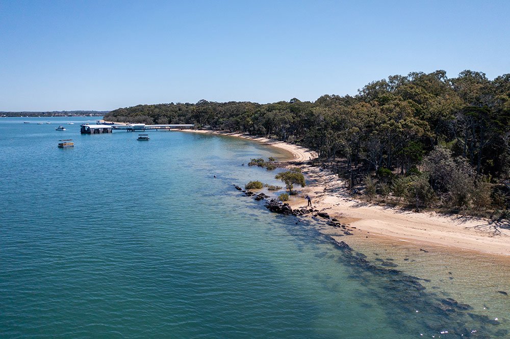
Main Beach is the busiest area of the island. It is the site of the jetty where ferries arrive and depart and the location of the most popular swimming beach. East of the jetty, under tall trees, there are recreation facilities, a boat-hire business, a flagpole and simple sandstone war memorial, the site of ANZAC Day and Remembrance Day commemorations. Flags are also raised here on Flinders Day, which recognises the explorer’s landing on the island in 1799. Regular craft markets are held, island residents celebrate Christmas Eve and the annual Curlew Count starts and finishes in this part of the Emerald Fringe.
Towards the Western end of Main Beach, there is a vehicular barge ramp that also serves as a boat launching facility for islanders and visitors. Victoria Parade South bisects the Emerald Fringe between the jetty and the barge ramp. There are car parks at both the jetty and barge ramp areas.
On the landward side of the road between the jetty and the barge ramp, Curlew Creek makes its way through the Emerald Fringe, parallel to the beach, from its headwaters in a small wetlands area within the island’s residential zone. Between the dunes and the road, some areas of the Emerald Fringe have been fenced for revegetation. There are also areas of open space where trees have been thinned and the mid storey and understorey removed to accommodate barbecues, shelter sheds and a curving concrete path that links the jetty and the barge ramp. Large trees, many used by nesting lorikeets, remain.
-
The South West zone of the Emerald Fringe includes woodland slopes, the Curlew Creek mouth and striking red cliffs of volcanic origin that give the island its name (see image 4). Curlew Creek flows through this part of the Emerald Fringe to its mouth just before the red rocks. The landward edge of Curlew Creek is densely wooded. Greenhood orchids, remarked upon by a tourist in 1938 can still be found here.
Dense woodlands on the landward side of the creek slope upwards towards Victoria Parade South. The road here is backed by a road reserve containing numerous veteran trees. From the vantage point of the water, the Emerald Fringe appears as a dense band of green.
The red cliffs west of the creek mouth are 12 - 15 metres high and are estimated to be 30 million years old. These cliffs can be seen from the mainland and are often used as an island symbol. A corrugated concrete path partially edged by stone walls leads from the red rocks up an embankment to Victoria Parade South. At the top of the cliffs, Flinders’ Lookout offers panoramic views of Moreton Bay and beyond to the south and the Border Ranges.
The Community Hall is located a short distance away on the cliff’s edge. Next to it, in the Emerald Fringe, are a number of historical monuments. Steps constructed as a Second World War memorial lead down to the golf course in the place of a cutting made by Doug Morton and known locally as the ‘Kyber (sic) Pass.’ In a wooded area close by the steps, there is a fenced ‘Lone Pine’ with a small sign telling the reader that it was planted in 1997 to commemorate the presence on the island of landing craft companies during World War Two.
-
The nine hole golf course (see image 6) with its attendant small club house (not considered to be of cultural heritage significance) is located on low-lying, gently undulating land on the South-Western tip of the island and covers an area of approximately 12.0 hectares. Numerous large veteran trees remain. The location also contains a number of Aboriginal cultural heritage sites that include the remains of shell middens and stone fish traps. The island’s European heritage is commemorated by a plaque attached to a concrete slab, the remains of the Company’s camp kitchen, made by sappers of the # 43 Landing Craft Company.
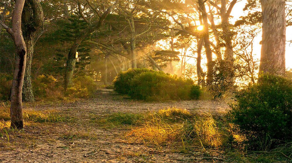
Beyond the golf course, the Emerald Fringe on the western side is one of the least developed parts of the island. The western cliffs run north-south on the island’s western side and vary in height from about 2 metres at the southern end to approximately 11 metres near the northern end. The heavily vegetated cliffs slope towards a rough walking track that lies between the base of the cliffs and a large mangrove forest spreading towards the mainland. There are a number of small caves towards the cliff’s northern end, separated from the path by fairly steep slopes. At the top of the cliffs, Victoria Parade West allows occasional flashes of water and mangroves through the trees.
Morton’s Steps cut through the southern end of the cliffs from Victoria Parade West to the path at the base of the cliffs. A sign at the top of the steps informs the reader that Morton built the steps to lead to one of five jetties that he constructed on the island. The cliffs’ northern end culminates in a look-out with views towards the Port of Brisbane and Peel Island, where it is possible to observe the regular crossings of the Stradbroke ferries and to watch the sun going down over the mainland. A steep concrete path leads down from the lookout towards Morwong Beach.
-
Morwong Beach is a sandy beach dominated by large stands of coastal hibiscus. It offers an alternative picnic and recreational site if winds are too strong at Main Beach. There is a cleared area with picnic tables, shelter shed and barbecue that also provides easy access to the beach. There is a sign pointing out nearby scarred trees and a midden. Further along Morwong Beach there are an old concrete boat ramp and a wooden seat looking out to Peel Island. Victoria Parade North is of concrete construction and runs behind the beach and its associated conservation zone from Elizabeth Street to the Melaleuca Wetlands walking track.
-
The Emerald Fringe on the Eastern side of the island is contiguous on the landward side with Ramsar melaleuca wetlands. A path and boardwalks through the wetlands allow islanders and visitors to enjoy the environmental values of this area. Signs in the Emerald Fringe at either ends of the wetlands welcome visitors in both the local Jandai Indigenous language and English. Four additional interpretive signs explain the flora and fauna of the wetlands to interested visitors.
Norfolk Beach is located on the island’s Eastern side between the wetlands and Main Beach. A walking and cycling track runs through the Emerald Fringe parallel with Norfolk beach. From here, there are pleasant views of Macleay and Stradbroke Islands as well as of passing sailing and recreational fishing boats. On the landward side of the track, there are low impact recreational facilities. On the seaward side, there are regular access points to the beach. A sign marks Flinders’ landing on Norfolk Beach and provides a brief history of the navigator and his connection with Coochiemudlo. Vegetation becomes heavier at the Southern end of Norfolk Beach where it joins Main Beach and the road opens to vehicular traffic on Victoria Parade East.
A winding concrete path threads through coastal scrub. Outrigger canoes used by the island’s regular group of early morning paddlers are stored in this area when they are not in use.
Articles from our community
~ about the Emerald Fringe


Additional resource — Life on Coochiemudlo Island
Link to the Life on Coochiemudlo Island website for additional environmental and cultural information about Coochiemudlo Island.